
Sarawak Travel Guide
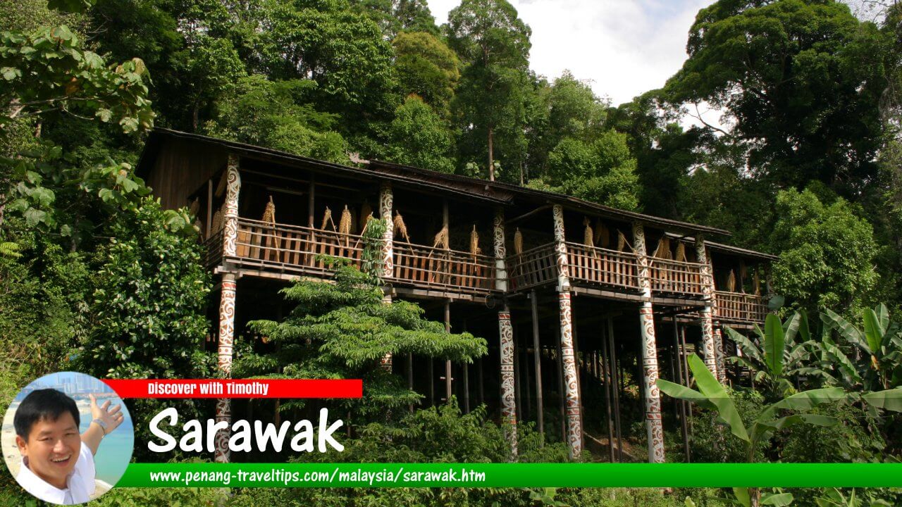 Sarawak (2 October 2004)
Also available: Panduan Melawat Sarawak
Sarawak, affectionately known as the "Land of the Hornbills", is the largest state in Malaysia, occupying a vast swath of northwestern Borneo. Covering an expansive area of nearly 124,000 square kilometers, Sarawak accounts for over 37% of Malaysia's total landmass, bordered by Sabah to the northeast, the Indonesian province of West Kalimantan to the south and southeast, the independent Sultanate of Brunei along its northern coast, and the South China Sea to the northwest.1 Famous for its world-renowned UNESCO World Heritage site—Gunung Mulu National Park—the state features some of the largest cave chambers and most extensive underground cavern networks on Earth, alongside 140-million-year-old virgin rainforests, winding tropical river systems, and rare endemic wildlife including the Bornean orangutan and proboscis monkey.2 Home to more than 30 distinct indigenous ethnic groups—collectively known as the Dayak—Sarawak blends exotic natural wilderness, unique colonial history under the Brooke dynasty, and vibrant cultural traditions into an unforgettable travel experience for local explorers and international visitors alike.
Quick Facts
- State Capital: Kuching
- Total Land Area: Approximately 124,450 km²
- Population: Over 2.5 million inhabitants
- State Emblem/Symbol: Rhinoceros Hornbill (Kenyalang)
- State Motto: "Sarawak Anew" / "Bersatu, Berusaha, Berbakti"
- Major Ethnic Groups: Iban, Chinese, Malay, Bidayuh, Melanau, Orang Ulu (Kenyah, Kayan, Kelabit, Lun Bawang, Penan)
- Primary Languages: Bahasa Malaysia, English, Sarawak Malay, Iban, Bidayuh, Mandarin, Hakka
- Top Attractions: Gunung Mulu National Park, Bako National Park, Sarawak Cultural Village, Semenggoh Nature Reserve, Niah National Park, Fort Margherita, Kelabit Highlands
- Local Delicacies: Sarawak Laksa, Kolo Mee, Ayam Pansoh (bamboo chicken), Midin (wild jungle fern), Umai (Melanau raw fish salad), Kek Lapis Sarawak (layered cake)
- Primary Gateways: Kuching International Airport (KCH), Miri Airport (MYY), Sibu Airport (SBW), Bintulu Airport (BTU)
An Overview of Sarawak
Sarawak is a land defined by dramatic rivers, sprawling rainforest basins, and ancient mountain ranges. Its geography dominated human settlement patterns for centuries, with major rivers such as the Rajang—Malaysia's longest river at 563 kilometers—serving as traditional highways connecting coastal trade posts to deep interior tribal longhouses.3
The state's modern history is unique within Malaysia. Originally under the sphere of influence of the Sultanate of Brunei, the territory entered a fascinating historical chapter in 1841 when English adventurer James Brooke was appointed Rajah of Sarawak after assisting the Sultan in quelling local rebellions. This established the century-long dynasty of the "White Rajahs" (James, Charles, and Vyner Brooke), who expanded Sarawak's borders and introduced administrative institutions while strictly limiting foreign corporate exploitation to protect indigenous tribal customs.4 Following Japanese occupation during World War II, Sarawak became a British Crown Colony in 1946 before joining the Malayan states, Sabah, and Singapore on September 16, 1963, to establish the nation of Malaysia.
Geography and Climate
Sarawak experiences a hot, humid tropical rainforest climate year-round, with coastal and lowland temperatures ranging from 23°C to 32°C. Highland regions such as Bario in the Kelabit Highlands offer cooler temperatures averaging 16°C to 25°C.
Rainfall is abundant across Borneo throughout the year, nourishing its dense jungle ecosystems. However, weather patterns are influenced by two primary seasons:
- Northeast Monsoon (November to March): Brings heavier downpours, rougher seas along the coast, and high river water levels across coastal and interior districts.
- Southwest Monsoon (May to September): Brings comparatively drier and sunnier conditions, making it the most favorable window for trekking, cave exploration, and national park visits.
Major Divisions and Towns in Sarawak
Sarawak is divided into 12 administrative divisions. The primary urban hubs serve as ideal basecamps for exploring surrounding rainforests, coastal beaches, and highland settlements.
Kuching: The Charming Waterfront Capital
Kuching, the capital of Sarawak, is widely considered one of Southeast Asia's most charming and walkable riverside cities.5 Situated along the banks of the Sarawak River, Kuching ("cat" in Malay) blends nineteenth-century colonial heritage, colorful Chinese shophouses, modern architectural landmarks, and laid-back waterfront dining.
Key attractions within Kuching include:
- Kuching Waterfront: A scenic 900-meter promenade along the river, perfect for evening strolls, sampan water taxi rides, and views of the floodlit Darul Hana Bridge and the grand Sarawak State Legislative Assembly (DUN) building.
- Fort Margherita and Brooke Gallery: Built in 1879 by Charles Brooke to guard the city against pirate attacks, this whitewashed fort now houses artifacts detailing the reign of the White Rajahs.
- Borneo Cultures Museum: Opened in 2022, this state-of-the-art facility is the second-largest museum in Southeast Asia, housing over 1,000 historic artifacts and interactive cultural exhibitions.
- Old Court House and Carpenter Street: The heritage heart of Kuching, packed with traditional artisan shops, heritage coffee shops (kopitiams), temples, and bistro bars.
Miri: Resort City and Gateway to World-Class Caves
Located in northern Sarawak near Brunei, Miri is the state's second-largest city and the historic birthplace of Malaysia's petroleum industry (marked by the "Grand Old Lady" oil well atop Canada Hill).6 Today, Miri is a vibrant resort city renowned as the primary stepping stone to Sarawak's subterranean national parks—Gunung Mulu and Niah—as well as the coral reefs of Miri-Sibuti Coral Reef National Park.
Sibu: Gateway to the Rajang Basin
Situated at the confluence of the Rajang and Igan rivers, Sibu is a bustling river port city with strong Foochow Chinese roots. It is famous for the towering 7-story Tua Pek Kong Temple, the sprawling Sibu Central Market (Malaysia's largest covered market), and as the primary riverboat transit point into the Iban longhouse heartlands along the Rajang River.
Bintulu and Sri Aman
Bintulu is an industrial coastal center known for natural gas processing, coastal parks, and Similajau National Park's coastal rainforest beaches. Sri Aman, situated on the Lupar River, is famous for Fort Alice and the annual Pesta Benak, celebrating the river's dramatic tidal bore wave.
National Parks, Caves, and Eco-Tourism
Sarawak contains one of the most comprehensive national park networks in Asia, protecting ecosystems ranging from mangrove swamps and coastal dipterocarp forests to colossal limestone cave systems.
Gunung Mulu National Park
Inscribed as a UNESCO World Heritage Site in 2000, Gunung Mulu National Park is the crown jewel of Sarawak's natural wilderness.7 Dominated by three majestic mountains—Gunung Mulu, Gunung Api, and Gunung Benarat—the park contains the most studied tropical karst cave system in the world.
Highlights of Mulu include:
- Sarawak Chamber: The largest known underground cave chamber in the world by surface area, capable of holding 40 Boeing 747 aircraft.
- Deer Cave: One of the world's largest cave passages, famous for the daily dusk phenomenon where millions of Wrinkle-lipped bats emerge in swirling formations to hunt insects.
- Clearwater Cave: Home to one of Asia's longest underground river cave systems, featuring crystal-clear subterranean streams.
- The Pinnacle Trail: A grueling trek up Gunung Api rewarding hikers with spectacular views of 45-meter-high razor-sharp limestone spires jutting through the rainforest canopy.
Bako National Park
Established in 1957, Bako National Park is Sarawak's oldest national park, located just 37 kilometers from Kuching.8 Despite its relatively small size (27 km²), Bako contains almost every vegetation type found in Borneo, including beach forests, mangrove swamps, cliff vegetation, and kerangas (heath forest). Bako is world-famous for its resident population of wild proboscis monkeys, bearded pigs, silvered langurs, and dramatic sea stack rock formations.
Niah National Park
Located near Miri, Niah National Park holds vast historical and archaeological importance. In 1958, archaeologists discovered the 40,000-year-old "Deep Skull" inside Niah's Great Cave, providing early evidence of human settlement in Southeast Asia.9 Visitors reach the massive cave mouth via a scenic wooden boardwalk through the rainforest, where local collectors can still be seen harvesting edible swiftlet bird nests from cave ceilings using long bamboo poles.
Semenggoh Nature Reserve
Situated 24 kilometers south of Kuching, Semenggoh Nature Reserve operates a renowned sanctuary for rescued and orphaned Bornean orangutans. Unlike a traditional zoo, the primates live freely in the surrounding forest reserve, returning to feeding platforms during twice-daily feeding sessions when forest fruits are scarce.
The Kelabit Highlands and Interior Wilderness
For adventurous travelers seeking off-the-beaten-path interior exploration, the Kelabit Highlands—a high mountain plateau near the Indonesian border—offers cool mountain air, terraced rice paddies, and traditional hospitality in settlements like Bario. The region is famous for producing Bario rice, sweet pineapples, and serving as a base for multi-day treks into primary rainforests inhabited by Penan communities and interior longhouse settlements.
Culture, Ethnic Diversity, and Festivals
Sarawak's human tapestry is defined by multi-ethnic harmony among its more than 30 indigenous groups, each maintaining distinct languages, longhouse architecture, oral traditions, and artisanal crafts.
Indigenous Peoples of Sarawak (The Dayak)
- Iban (Sea Dayak): The largest indigenous group in Sarawak, historically known for headhunting customs, intricate Bungai Terung tattoos, woven Pua Kumbu textiles, and communal living in traditional timber longhouses along major rivers.
- Bidayuh (Land Dayak): Concentrated in the mountainous regions around Kuching and Serian, famous for circular bamboo longhouses (Baruk), bamboo engineering, and warm hospitality.
- Melanau: Coastal inhabitants historically known for sago farming, boat-building expertise, and raw fish delicacies like Umai. While many Melanau have adopted Islam or Christianity, ancient spiritual traditions remain celebrated.
- Orang Ulu: A collective term for upriver tribes including the Kenyah, Kayan, Kelabit, Lun Bawang, and Penan, renowned for elaborate wood carvings, beadwork art, earlobe stretching customs, and melodic stringed music played on the Sape'.
Sarawak Cultural Village
Located at the foot of Mount Santubong near Damai Beach, the Sarawak Cultural Village is an award-winning living museum. It features authentic full-scale longhouses and traditional dwellings representing the Iban, Bidayuh, Melanau, Orang Ulu, Penan, Malay, and Chinese communities, culminating in daily multi-ethnic cultural dance performances inside a modern theater.
World-Class Festivals
- Rainforest World Music Festival (RWMF): An internationally acclaimed three-day music festival held every June at the Sarawak Cultural Village, bringing together renowned tribal musicians, global world-music acts, and cultural workshops beneath Mount Santubong.10
- Gawai Dayak: Celebrated annually on June 1st and 2nd, Gawai is the major harvest festival of the Dayak communities. Longhouses open their doors to guests for traditional rice wine (Tuak), gong music, warrior dances (Ngajat), and communal feasting.
Sarawakian Culinary Delights
Sarawak features a distinct culinary culture shaped by native jungle herbs, wild river produce, Chinese cooking styles, and indigenous preservation techniques.
Must-Try Local Dishes
- Sarawak Laksa: Made famous globally by the late chef Anthony Bourdain (who called it the "Breakfast of the Gods"), this iconic dish features thin rice vermicelli topped with shredded chicken, prawns, omelette strips, and bean sprouts in an aromatic, complex broth made from sambal belacan, coconut milk, tamarind, and aromatic spices.
- Kolo Mee: Springy egg noodles tossed in lard or vegetable oil, light soy sauce, and fried shallots, topped with savory minced pork or chicken, sliced char siu, and scallions.
- Ayam Pansoh (Manok Pansoh): A traditional Dayak dish where chicken marinates with lemongrass, ginger, garlic, tapioca leaves, and local herbs, packed inside a hollow bamboo stalk and cooked over open charcoal flames.
- Midin: A wild jungle fern endemic to Sarawak's forests, stir-fried quickly with garlic or spicy sambal belacan to preserve its sweet, crunchy texture.
- Umai: A traditional Melanau seafood delicacy consisting of thinly sliced raw fresh sea fish (or prawns) cured in lime juice, onions, chilies, ginger, and roasted peanuts.
- Kek Lapis Sarawak (Sarawak Layered Cake): Vibrant, meticulously baked layered cakes featuring intricate geometric patterns, colors, and flavors, popular as souvenirs during festive seasons.
Getting to and Around Sarawak
Modern air and highway transit links connect Sarawak's coastal gateways, while interior travel often involves scenic river boats or light aircraft flights.
By Air
Kuching International Airport (KCH) and Miri Airport (MYY) are the primary entry points, handling direct flights from Kuala Lumpur, Penang, Johor Bahru, Sabah, and international hubs such as Singapore. Domestic regional flights operated by MASwings link smaller inland communities like Bario, Ba'kelalan, and Mulu via Twin Otter aircraft.
By Road and River
The Pan-Borneo Highway links Kuching, Sibu, Bintulu, and Miri across Sarawak's coastal belt. Express buses connect major urban centers, while express passenger boats operate along major river corridors such as the Rajang River.
Conclusion
From the subterranean wonder of Mulu's caves and the wild orangutans of Semenggoh to the rhythmic sounds of the Sape' and warm longhouse hospitality, Sarawak offers a rich, untamed Bornean experience. Its combination of natural heritage, diverse cultures, and unique history ensures a deeply rewarding destination for every traveler.
Map of Towns in Sarawak
- Kuching - capital (GPS: 1.56, 110.345)

- Bintulu (GPS: 3.17132, 113.0419)

- Kota Samarahan (GPS: 1.45971, 110.49917)

- Lundu (GPS: 1.67213, 109.8536)

- Miri (GPS: 4.39949, 113.99138)

- Sarikei (GPS: 2.1317, 111.52372)

- Sibu (GPS: 2.28728, 111.83053)

- Sri Aman (GPS: 1.23668, 111.46256)

Categories of sights in Sarawak
- TOWNS IN SARAWAK
- Beaches in Sarawak
- Caves in Sarawak
- Chinese temples in Sarawak
- Churches in Sarawak
- Hawker Centres in Sarawak
- Hospitals in Sarawak
- Monuments in Sarawak
- Mosques in Sarawak
- Mountains in Sarawak
- Museums in Sarawak
- National Parks in Sarawak
- Police Stations in Sarawak
- Rivers in Sarawak
- Shopping malls in Sarawak
- Streets in Sarawak
Map of National Parks in Sarawak
National Parks & Wildlife Sanctuaries in Sarawak
- Bako National Park
- Batang Ai National Park
- Bukit Tiban National Park
- Fairy Cave & Wind Cave
- Gunung Buda National Park
- Gunung Gading National Park
- Gunung Mulu National Park
- Kubah National Park
- Kuching Wetlands National Park
- Lambir Hills National Park
- Lanjau-Entimau Wildlife Sanctuary
- Loagan Bunut National Park
- Maludam National Park
- Matang Wildlife Centre
- Niah National Park
- Pulong Tau National Park
- Rajang Mangroves National Park
- Sama Jaya Nature Reserve
- Samunsam Wildlife Sanctuary
- Semenggoh Wildlife Rehabilitation Centre
- Similajau National Park
- Talang Satang National Park
- Tanjung Datu National Park
Mountains in Sarawak
Major Rivers in Sarawak
References
- Sarawak Government Official Portal. https://www.sarawak.gov.my
- Department of Statistics Malaysia (DOSM) - Sarawak State Profile. https://www.dosm.gov.my
- Department of Irrigation and Drainage Sarawak - Rajang River Basin. https://did.sarawak.gov.my
- Sarawak State Museum Department - History of the Brooke Era. https://museum.sarawak.gov.my
- Kuching North City Hall (DBKU) & Kuching South City Council (MBKS). https://dbku.sarawak.gov.my
- Miri City Council (Majlis Bandaraya Miri). https://miricouncil.gov.my
- UNESCO World Heritage Centre - Gunung Mulu National Park. https://whc.unesco.org/en/list/1013/
- Sarawak Forestry Corporation (SFC) - Bako National Park Guide. https://sarawakforestry.com
- Sarawak Forestry Corporation - Niah National Park Archaeology. https://sarawakforestry.com
- Sarawak Tourism Board (STB) Official Portal. https://sarawaktourism.com
Page Details
This page was created on 28 July 2026. Hi, my name is Timothy and created it from my research, for my own entertainment, knowledge and to satisfy my curiosity. I am providing the information to you in good faith and hope it is useful. I try to get the details as accurate as possible. I also try to update the page whenever I stumble on new details. So this and all my other pages are perpetual work in progress. If you discover any error, please politely inform me, pointing out where the error lies, and I will correct it as soon as possible. Your helpfulness will keep this page accurate, relevant and helpful to those who need the information.My Videos of Malaysia
 Latest Pages & Updates
Buy Me A Coffee
If you enjoy the information I provide and want to support the work I do, please buy me a coffee! I appreciate it immensely, thank you so much!
